Map
Clip “Open in Caltopo” to see detailed map annotation.
Route Description
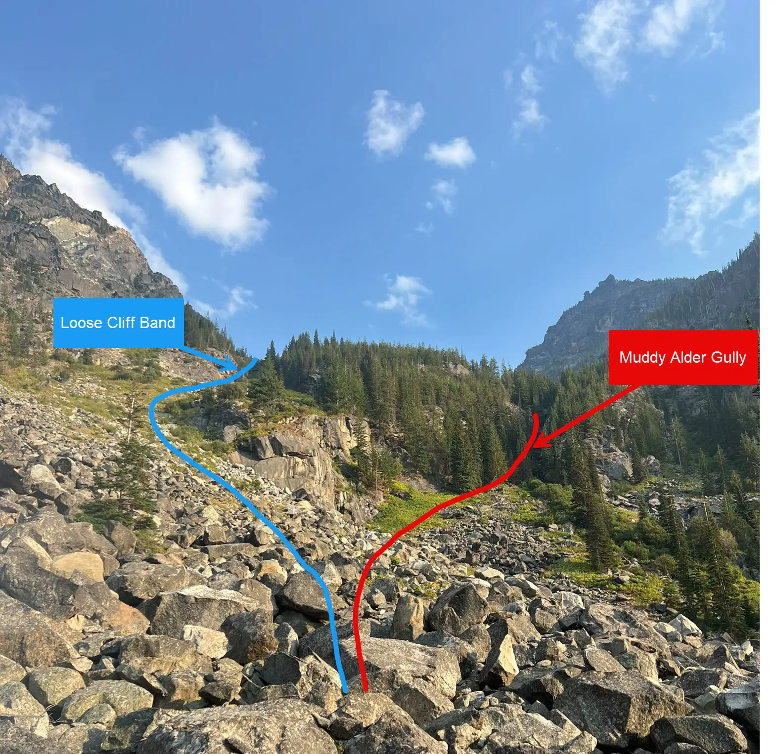
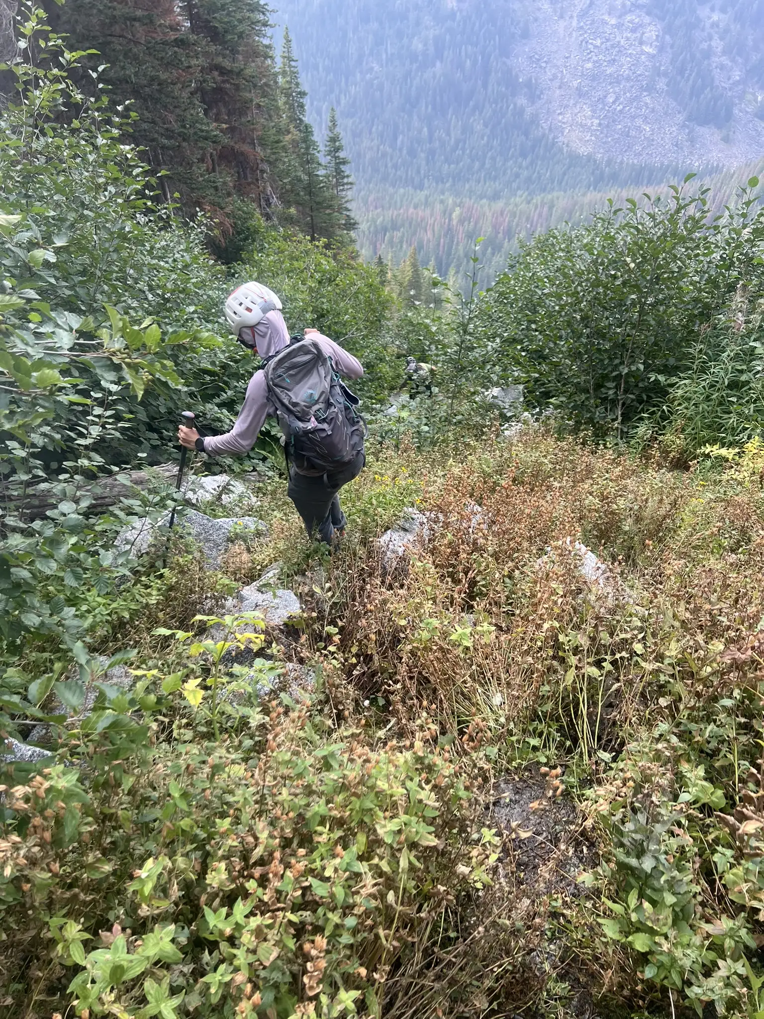
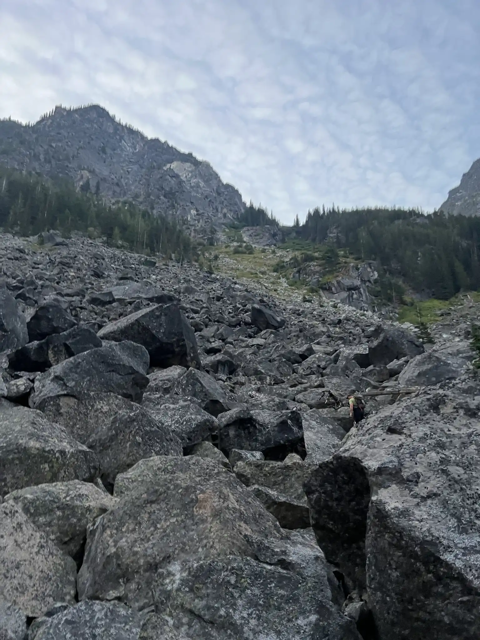
Start from the Stuart Lake Trailhead and hike 1.3 miles on the main trail before leaving it. Climb about 400 feet through light forest with faint boot paths, then cross an 800-foot boulder field. At 5,200 feet reach the crux, where you can either scramble up a short loose cliff band on the left or bushwhack through dense alder with mud and water on the right.
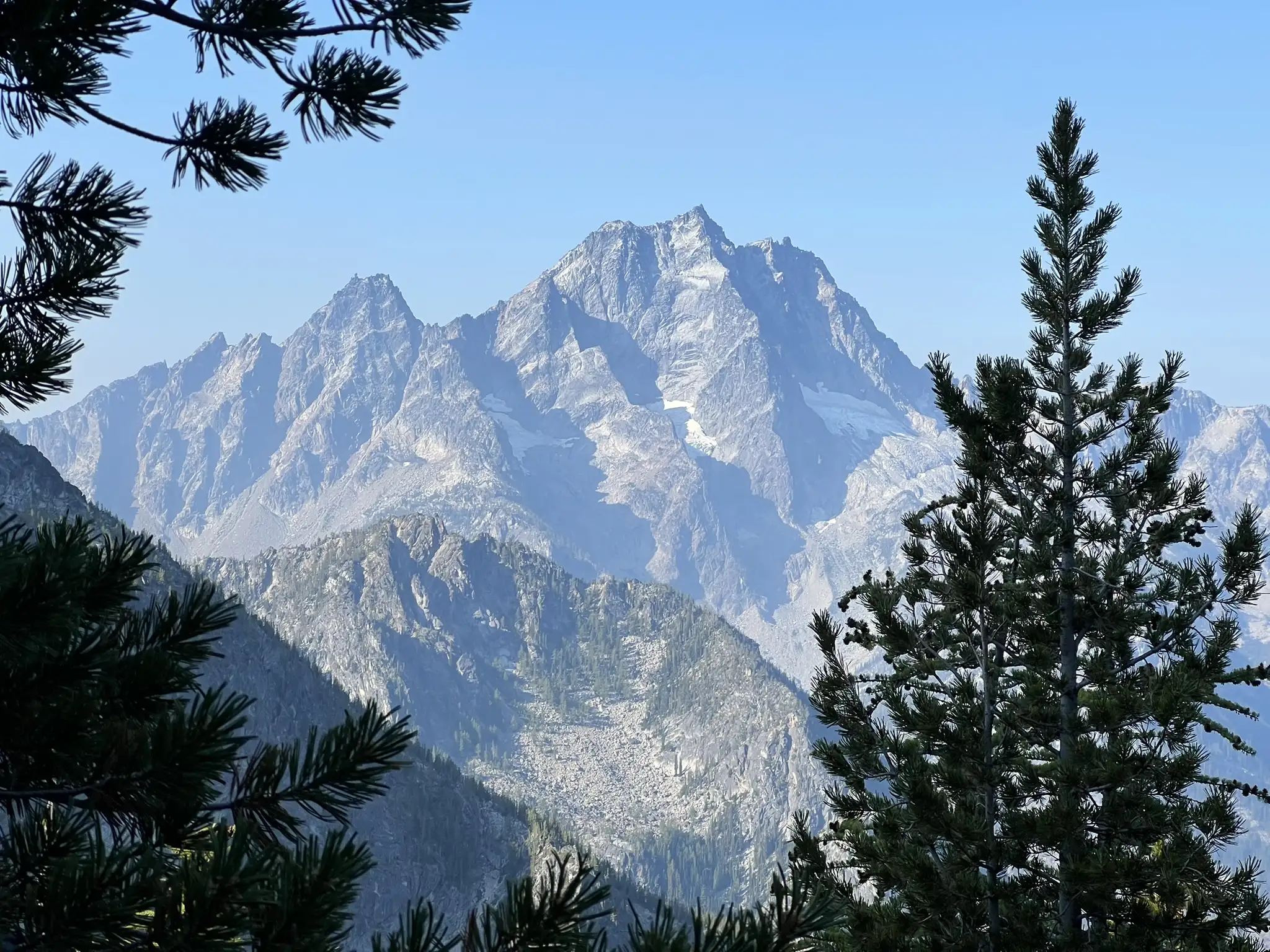
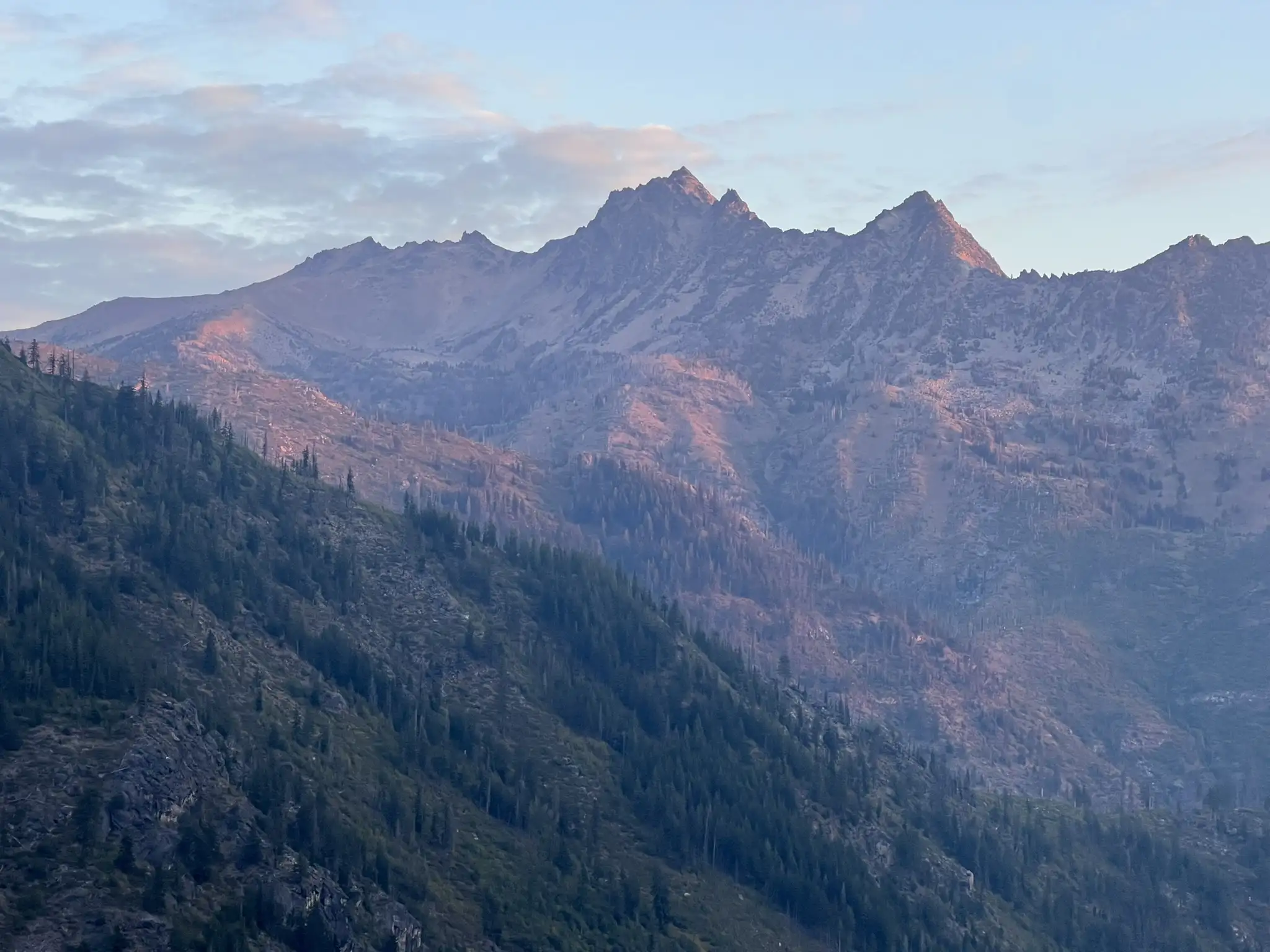
Continue under the right side of a rocky face to reach a flat area with water at 6,200 feet. From there, ascend to 7,500 feet, pass a short cliff band, and gain the southwest ridge. Scramble along solid Class 3 granite with mixed walking sections until reaching the summit slab. The slab is less steep than it appears in photos, very grippy, and secure with careful footwork.
For the descent, you can either return the same way or continue through Prusik Pass and core zone trail, which adds about ten miles and 1,500 feet of gain. But latter seems took more time according to a few trip report.
Trip Report
We camped at Bridge Creek Campground the night before and left at 4:45 am, driving to the Stuart Lake Trailhead. It was my first time there, and even at that early hour on a Saturday, the lot was nearly full. Fortunately, we snagged one of the last few spots.
Starting at 5:30 am, we hiked the busy trail for 1.3 miles before heading off-trail. The first 400 ft through the forest was straightforward, with ankle-high brush and a faint boot path. Navigating in the dark through forest wasn’t an issue for us. Soon we reached an 800 ft boulder filed. On the ascent it was manageable, but on the way down it felt endless and exhausting for both Chutang and me.
At 5,200 feet we reached the crux of the route. The options were to scramble up a short but loose cliff band on the left or to push through a muddy alder gully with water running beneath it on the right. We chose the cliff band on the way up and the gully on the way down. Neither felt much better than the other.
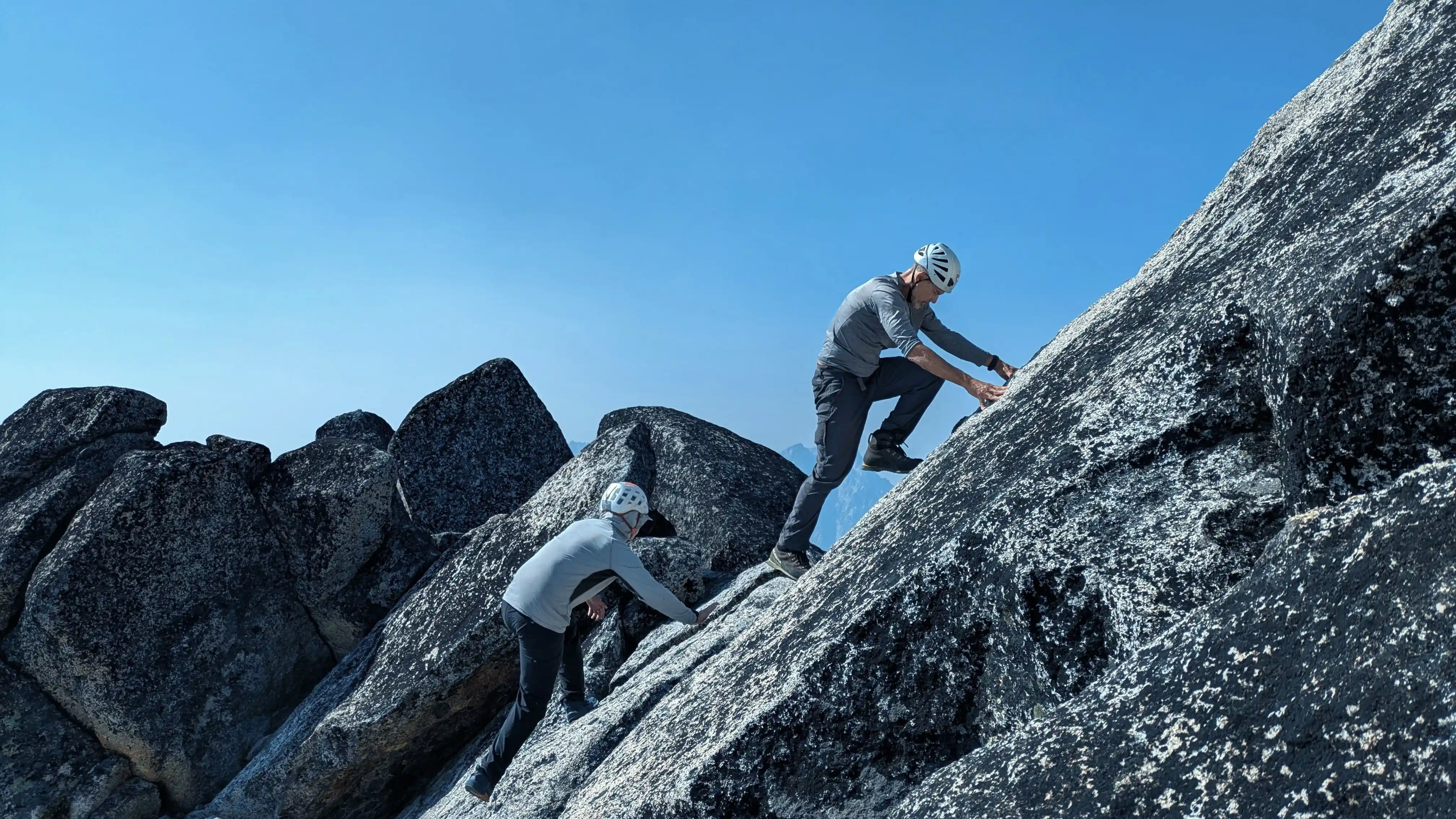
After the crux we stayed below the right side of a rocky face and reached a flat bench at 6,200 feet with a good water source. This was an ideal place to rest and refill. Continuing upward, we passed a short cliff band at around 7,500 feet and gained the southwest ridge. The ridge scramble was enjoyable, with solid granite and a mix of Class 3 moves and walk-ups. This brought us to the base of the summit slab.
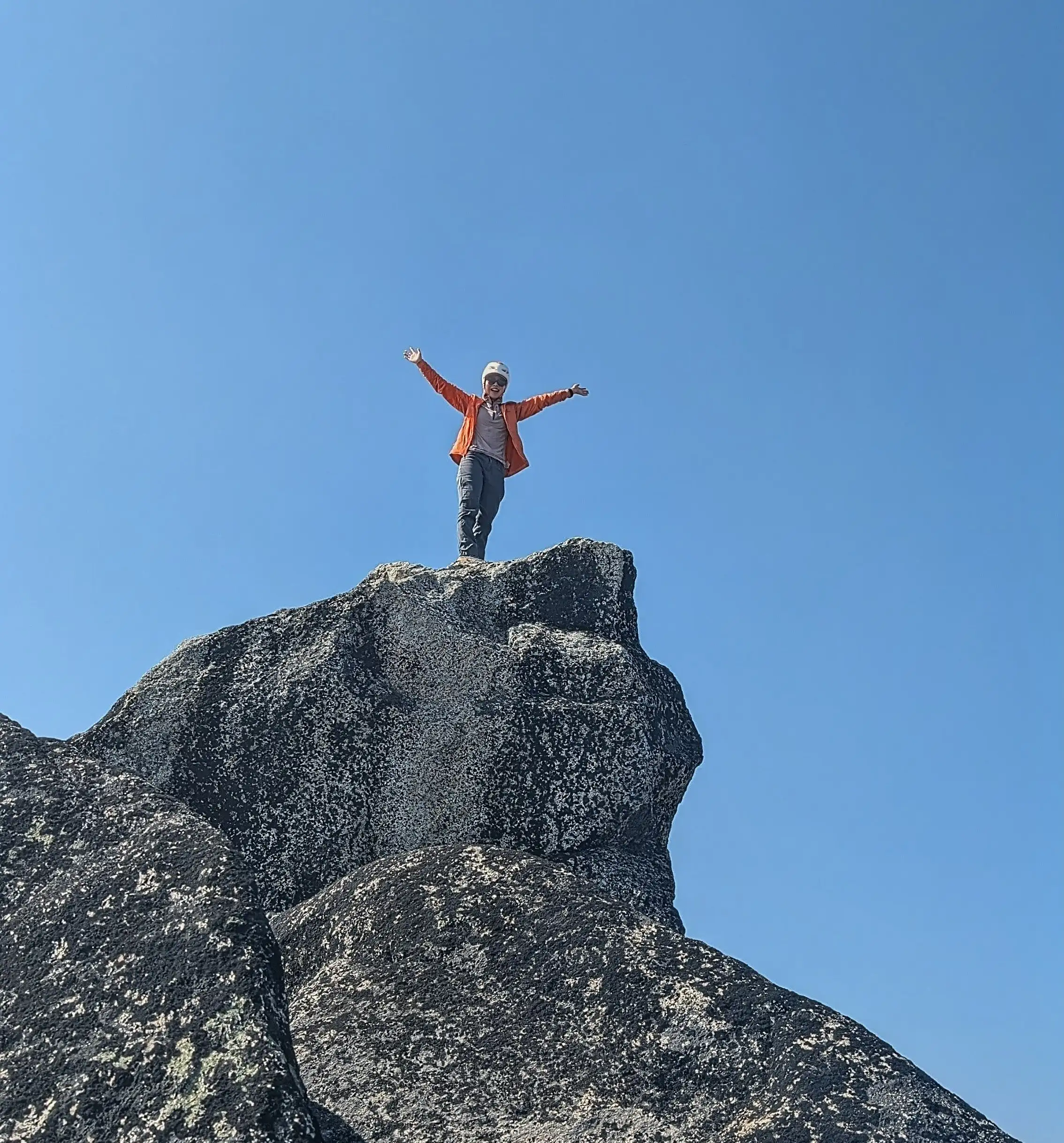
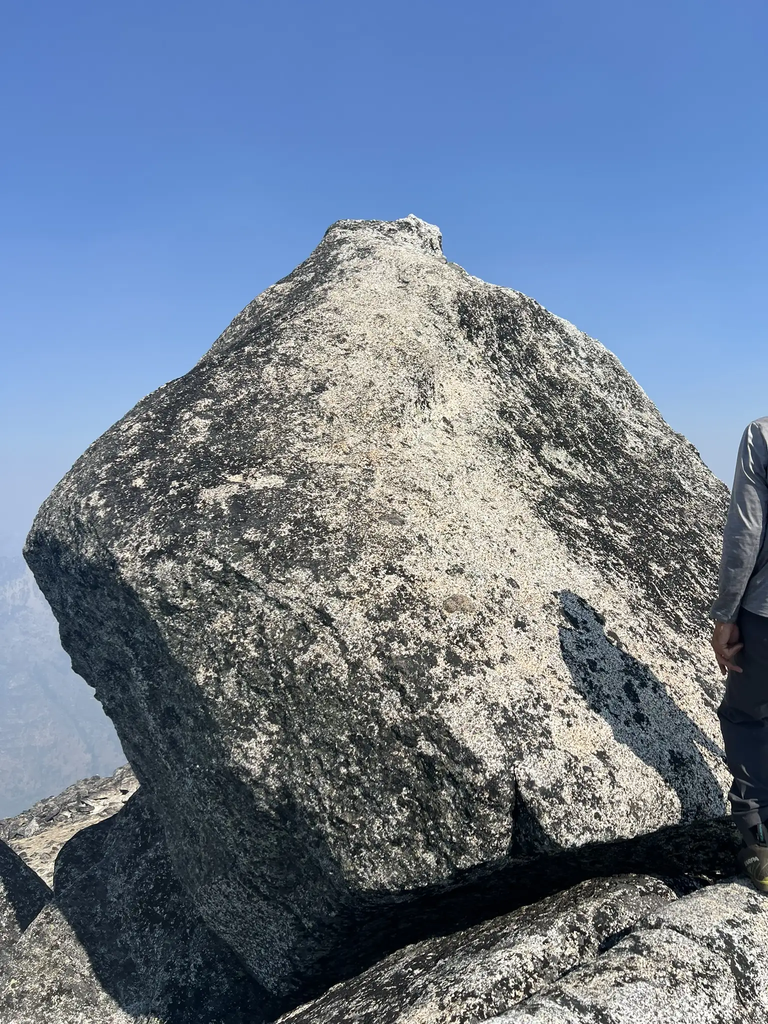
The summit slab looked intimidating in photos but proved easier in person. The angle was not as steep as it appeared and the granite was very grippy. There were no obvious handholds, but the rock had grooves that provided some good footing. I climbed up without issue. But the descent we definity need to be careful. I chose to downclimb facing in, while Chutang descended sitting facing out and noted that the friction was so strong so facing out might be a better option.
For the descent we chose the southwest face rather than the ridge because the ridge involved a few tricky moves on the way up. At 7,800 feet we encountered a cliff band that required each of us to downclimb one at a time. With five people in the group it took about twenty minutes to get through. Staying closer to the ridge might have provided a cleaner line. At 5,200 feet we descended through the alder gully. It was muddy, steep, and brushy, but the loose cliff band alternative did not seem much better with 5 person in group. If you go with 2 people, it may be better option because it is easier to manage the loose rock.
The long off-trail section on the descent wore us down. The boulder field seemed endless, and both Chutang and I struggled. She slipped several times, and the pace was slow. We reached the summit in about six hours, but the entire trip took thirteen hours because the two of us slowed the descent. Our other teammates spent a lot of time waiting for us. A stronger party could complete the descent much more quickly.
GPS: https://www.peakbagger.com/climber/ascent.aspx?aid=2982497