Route Description
The crux of the route has two loose rock traverses with an easy section between them. The traverses are not very hard or exposed, but the rock is loose. Other than that, it is mostly off-trail hiking or easy scrambling.
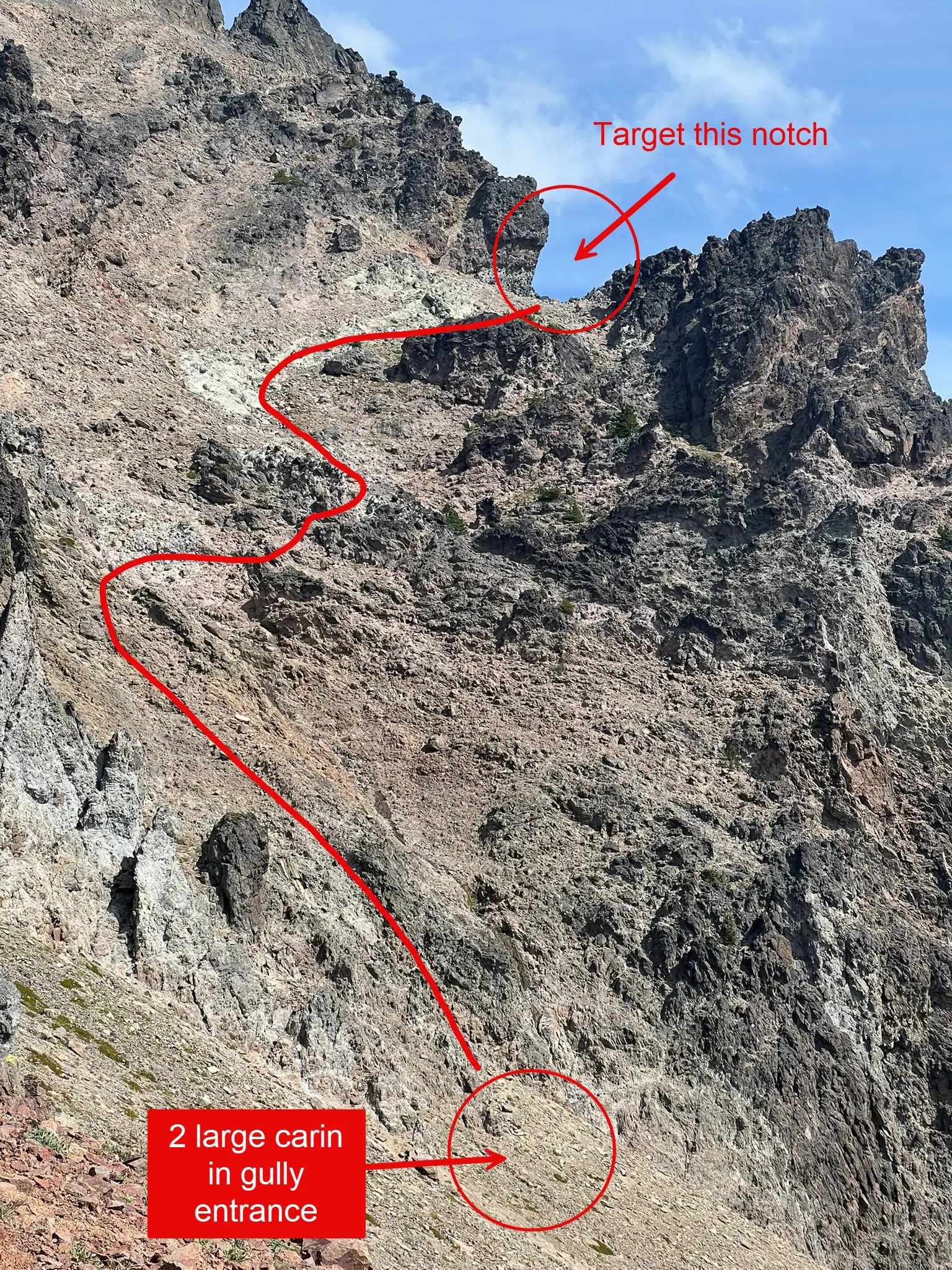
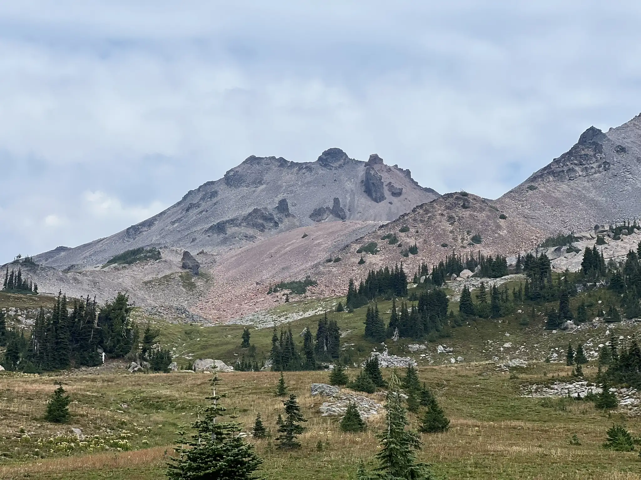
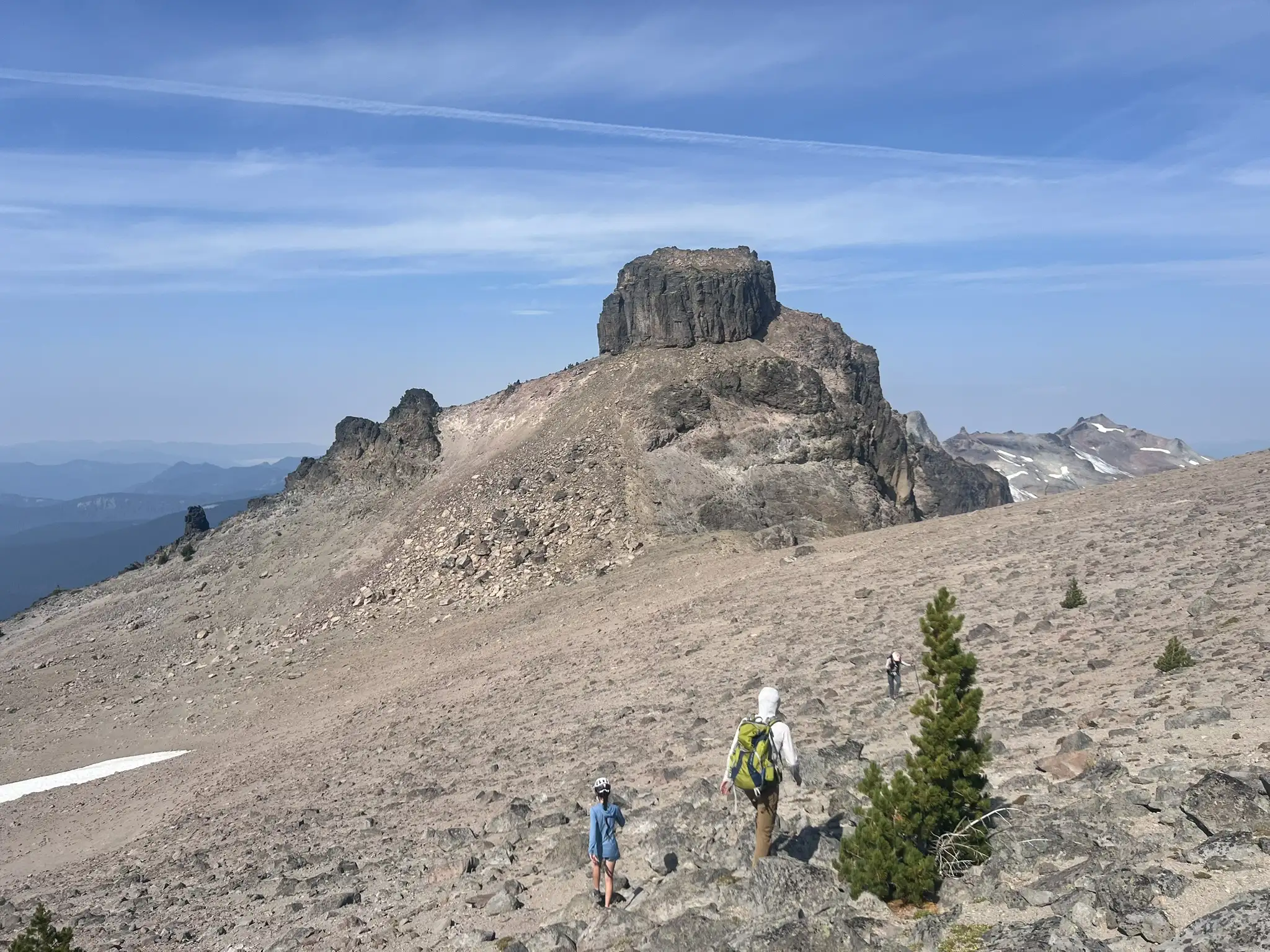
From the PCT, hike into Cispus Basin. Then climb up toward the 6900 ft point on the ridge. Descend and contour around the hill toward the entrance gully. The gully is between two large cairns.
1st Traverse
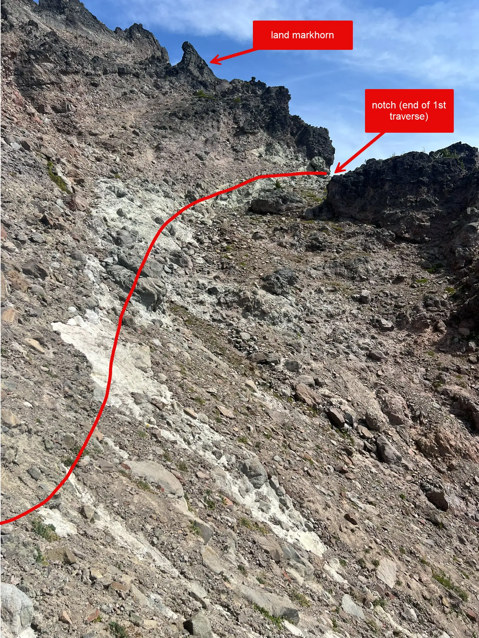
The gully between the two cairns marks the start. You can see a big notch at the far end of the traverse. Climb the gully until it steepens. Look for a cairn on the right. From there, traverse across a band of white rock. Cairns mark all the way to the notch. Route finding is not too hard if you aim for the notch. I drew an approximate line to show the way.
Easy Traverse
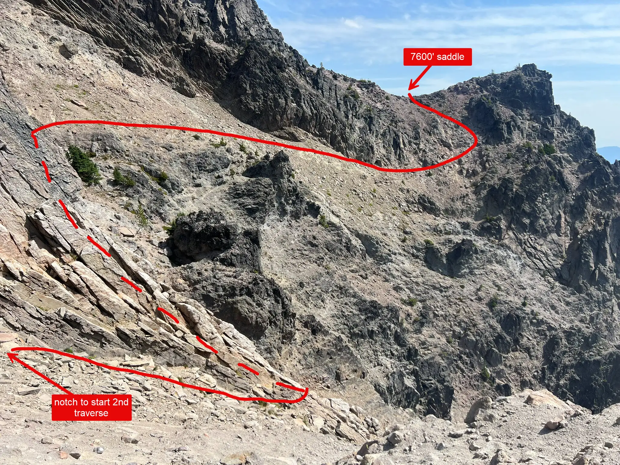
From the notch, cross two small saddles. Ahead you’ll see a big white ledge and a basin. That’s where the second traverse starts.
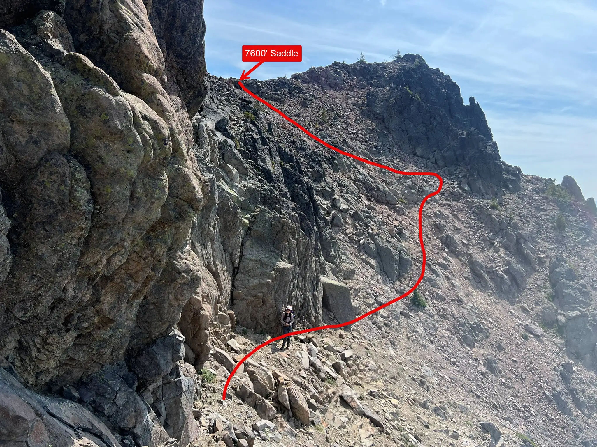
2nd Traverse
Drop down the white ledge and cross the bottom. Then climb back the elevation you just lost. Keep traversing at the same level, maybe a bit lower. After passing a wall with a good handhold on your left side, climb up to the 7400 ft saddle. The route here is easier and more obvious than the first traverse.
Rest of route
The final section is straightforward compared to the traverses. Hike up the broad slope and ridge toward the peak. When a bump blocks the ridge, look for a hole in the rock and cross to the right. At the base of the summit block, climb green-tinted class 3 rock, then finish with a short scramble to the top.
Trip Report
Day 1
We arrived at the Snowgrass Flat Trailhead at 9 am. The large parking lot was already full, so we had to park along the road. Luckily, the road is wide enough that cars could still pass without trouble. The trail was busy with hikers, most of them backpackers. By the time we reached Snowgrass Flat around noon, most of the obvious and good campsites were already taken. We were lucky to find a large campsite on a spur trail. There were tents everywhere. When we got back from Old Snowy Mountain later that day, every possible campsite was claimed. I estimated about 100 tents in the area.
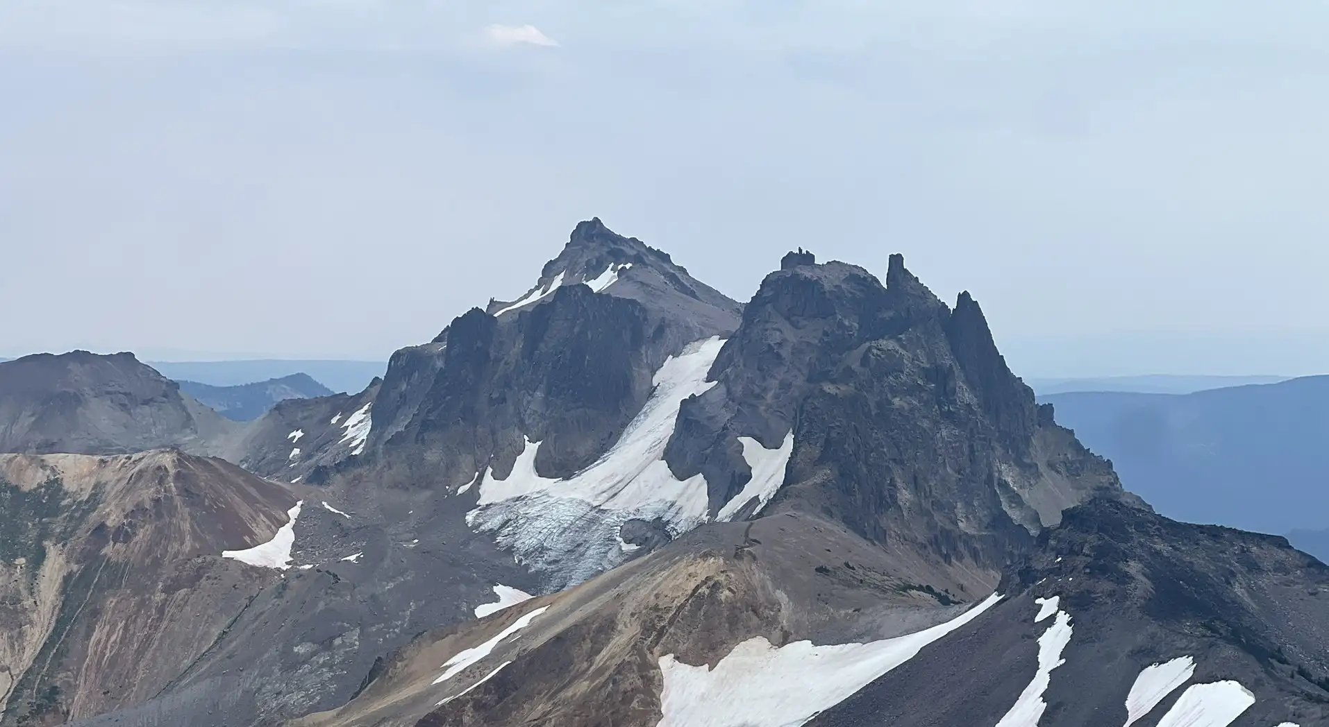
After setting up camp, we hiked to Old Snowy Mountain, a smooth peak above the PCT. The trail was crowded, with many people from Snowgrass Flat and Goat Lake making the same trip. We had expected some scrambling, but it turned out to be just a trail all the way to the summit.
Day 2
We started at 6 am for Gilbert Peak. The approach from Snowgrass Flat is long. We covered 3.5 miles on the PCT to reach Cispus Basin. If you only plan to climb Gilbert Peak, it makes sense to camp at Cispus Basin. But even though it’s less crowded than the Snowgrass area, all the campsites there were still occupied. The sites right above the PCT aren’t very big either.
We filled up at the Cispus River (more of a stream here) and headed toward the entrance gully. We had no trouble finding it. But at first we went the wrong way half way ascending the gully, because we aimed for the wrong notch. As long as you aim for the right notch, the route finding isn’t too bad. There are cairns along the way, though not continuous. After the first traverse, the easy traverse and second traverse were much simpler. At that point, route finding was straightforward as long as you had a general sense of your target direction.
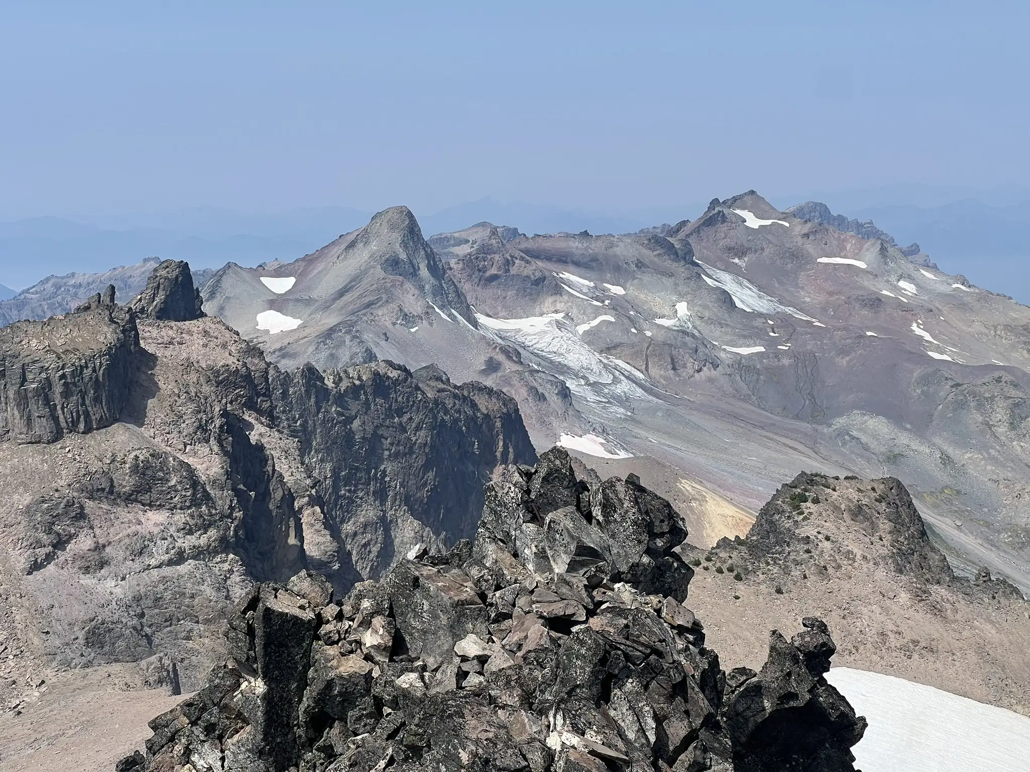
At the end of the second traverse, we climbed up to a saddle with a clear view of the rest of the route. From there, the ridge was gentle, and after a short scramble we reached the summit of Gilbert Peak. There was a nice new summit register, placed earlier this year (2025).
We had hoped to tag Ives Peak on the same day, but the loose terrain wore us down and we ran out of time. Mentally, we were already spent. We retraced our route back to Snowgrass Flat, reaching camp at 5 pm. The round trip to Gilbert Peak was 11 miles and took us 11 hours.
Day 3
We did Ives Peak and hiked out on day 3. You can check my trip report for Ives Peak. https://www.hippohamster.com/posts/south_cascades/ives_peak/
GPS: https://www.peakbagger.com/climber/ascent.aspx?aid=2967874